Resource mapping

COLLABORATIVE STUDY ON RANGELAND ASSESSMENT IN WAJIR WEST SUB- COUNTY

The landscapes of Wajir West Sub county support the larger pastoral communities which depend on livestock for their livelihoods. The Rangelands in this region are compromised by recurring floods, sand dunes with subsequent droughts which has resulted in vegetation biodiversity loss, stressed soil health, rampant hard pans as well as emergency of invasive species. Poor grazing management systems is a contributing factor to reduced functionality of Wajir rangelands.

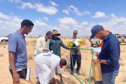
TRAINING OF TRAINERS FROM 12 ASAL COUNTIES ON SUSTAINABLE RANGELANDS MANAGEMENT AND PARTICIPATORY RANGELAND RESOURCES

Dr. Oscar Koech from the University of Nairobi (UoN), Department of Land Resource Management and Agricultural Technology (LARMAT) facilitated Training of Technical team from ASAL counties (Isiolo, Marsabit, Samburu, Narok, Kajiado, Kitui, Machakos, Makueni, Meru, Tharaka Nithi, Garissa, Tana river, TaitaTaveta) from the Ministry of Agriculture, Livestock and Fisheries, State Department of Livestock on Sustainable Rangelands Management and Participatory Rangeland Resources Mapping from 28th Feb to 4th March 2022.